#0248 Checking Out the Map Styles
This is the forth close look at terrain #0248 Archerland. The previous posts look at the 1st & 2nd Ages, early epochs and Dry Mesa.
Each Succession Map comes in 10 styles to cover different uses. This post discusses each style in turn and how it may be useful.
3D Terrain
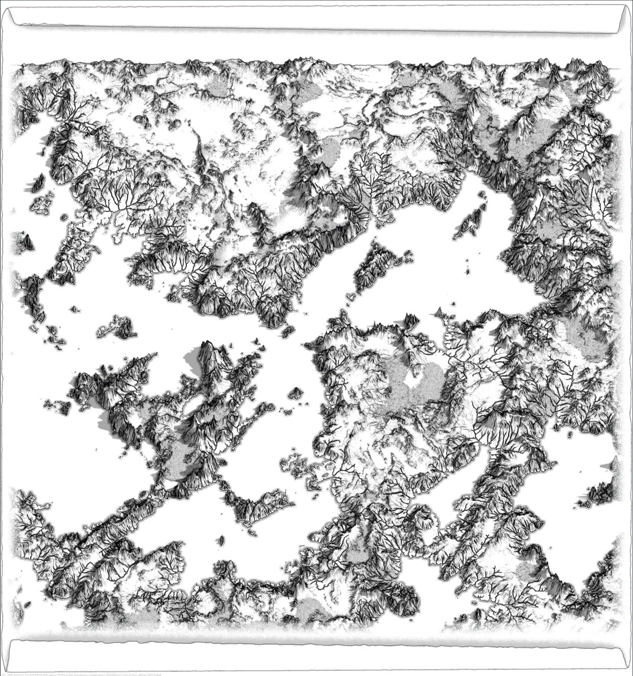
The 3d terrain shows up a lot on this blog as its the best overview map. It shows the layout, height and details all in reasonable detail. Because its leaned back detail gets lost futher back. It also suggests strongly that North is away from you which may not suit your campaign.
This style was made as a campaign creation tool, to aid building narratives from the terrain. Its easy to scoot around in a viewer and see the lay of the land.
Though it gives a good sense of scale, it wasn’t envisaged as the one you’d draw your campaign map on. It has a few hurdles for map makers who are not practiced artists. Working in 3D can be tricky if you’re not used to it. Making your creations show up clearly on such a high colour, high detail map is also a challenge.

3d terrain view of Archerland’s Primordial age.
2D Maps
The 2d maps are intended for game masters as the authoratitive campaign map. From the top view all details are of equal clarity and nothing is hidden behind a mountain.

The full colour version serves as a bridge between the 3d style and the map styles so that plans made while making up histories can more easily be scribed onto a 2d map.
The full colour map also provides Google Maps type information about features not present on the maps like beaches, snow and forests. Though you may not use this view as your map, its helpful to have a reference for small details.

This map was intended as the campaign map for authoring digitally.
This is a classical map. It has a grid, contour lines, colour graduated height and a big of shadow to help the 3d terrain pop.
It doesn’t have a scale or compass so you’re free to choose how big a space this is and where it is in your world.

This is the print friendly version of the map. For those, like myself, who enjoy crafting, drawing with pencils and colouring a map by hand, this is a pleasant way to spend down time.
Poster printing this map over 4 or 9 A4 sheets gives a decent amount of space to draw on.
For using the different epochs for campaign creation it can be worth printing the initial maps on single A4 sheets. As you get closer to the epoch you intend to use for your campaign, print off the maps across more sheets to get into the detail.
2.5D Maps
The 2.5D maps centre around the Tolkein style parchment map. Though they are 3d in that their mountains and hills point upwards, thay have no perspective so do not shrink at distance.

The 2.5d Terrain is the Tolkein style version of the 3d map. It acts as a bridge between the 3d and 2d styles.
Like the other terrains it has all the details plus a bit of sky and cloud at the top to help bed-in the map.
This style is intended to help game masters interpret the parchment styles giving more clear information.

For fantasy campaigns this is intended as the players map.
It has all the geographical height and layout of water in exquisite detail but in this style its more suggestive than exact.
It isn’t shy about showing forests, beaches, cliffs and snow but is also vague about this information usually only hinting where features begin and end.
For game masters using this map for their players, hiding secret details might be tricky as it has a distinct texture. To help with this here is a blank version of the parchment.
As with the 2d styles, this is a print friendly version of the Tolkein style map.
For those with an artistic bend this is also a more useful map than the parchment. Having just the lines you’re able be creative with your own backgrounds and its for easier to edit and play with.
For those who prefer to age their maps using crafting techniques its quite straight forward to blank out the parchment outline in an art app.
Heat Style Images

The scanner view is a play aid rather than a map. It shows the terrain as a heat map in a distinctly sci-fi style.
For science fiction games such as Rogue Trader going to different planets can seem like just popping down the road. The majesty and objective time it takes to travel through the stars gets in the way of play so visiting planets can become pedestrian.
Using the other maps ad-hoc to give a sense of scale to small planetary locations can help but getting player to find places can add a dimension of gameplay.
This style is intended as a visual tool for game masters to make some play around hunting for or scouting planetary sites.

This heat map is a navigation aid for game masters to effectively use the heat scanner styles. Deserts are pale, water is dark and shadow is a bit darker.
This map is in the 3d view so it can be easily compared to the 3d terrain so a game master has all the information about a region while players have the bare minimum.

As with the other styles this is the print friendly version.
As well as having less colour, it also has cut lines between the scanner images so you can give different players different views if you like.
The numbers in the top left of each image are generated from the landscape and the viewpoint. Each view of each landscape shares the same number regardless of the epoch being looked at. If you want a reason for the view or map to be thousands of years out of date but comes up as the right one, this may help.
The Long Number
In the bottom left corner of every image with the copyright message is some identifying information about the map.
The time period and map name are followed by the map number from the series. In this case the map is #0248 of a possible 500.
Following this is the long number that uniquely identifies each image. It states the image style and period followed by a long number starting with a few zeros. This number is the seed used to generate the landscape.
If you’re running some type of contemporary mystery with multiple maps, you may find these numbers useful.
